Pavement rutting can be defined as a linear surface depression that develops in the wheel-path area. Rutting can be characterized as relatively narrow, or wide, and can be confined to two paths or to multiple paths depending on the nature of the traffic which the roadway is exposed to.
Rutting impacts roadway safety as it can direct vehicles along an unintended path and can also prevent proper drainage and contribute to hydroplaning.
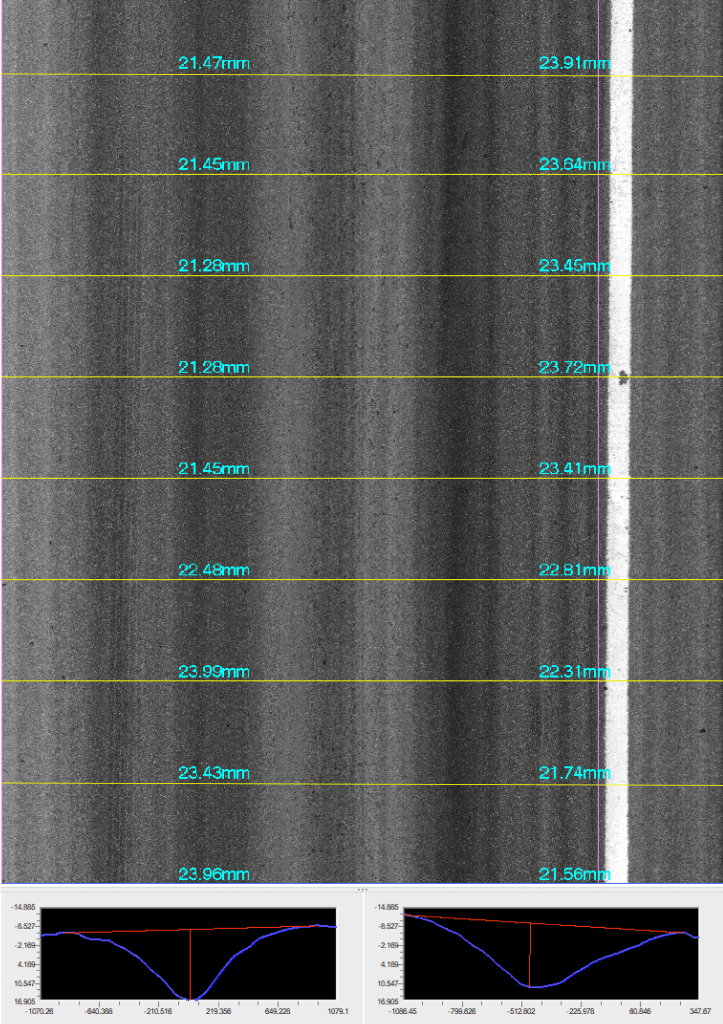
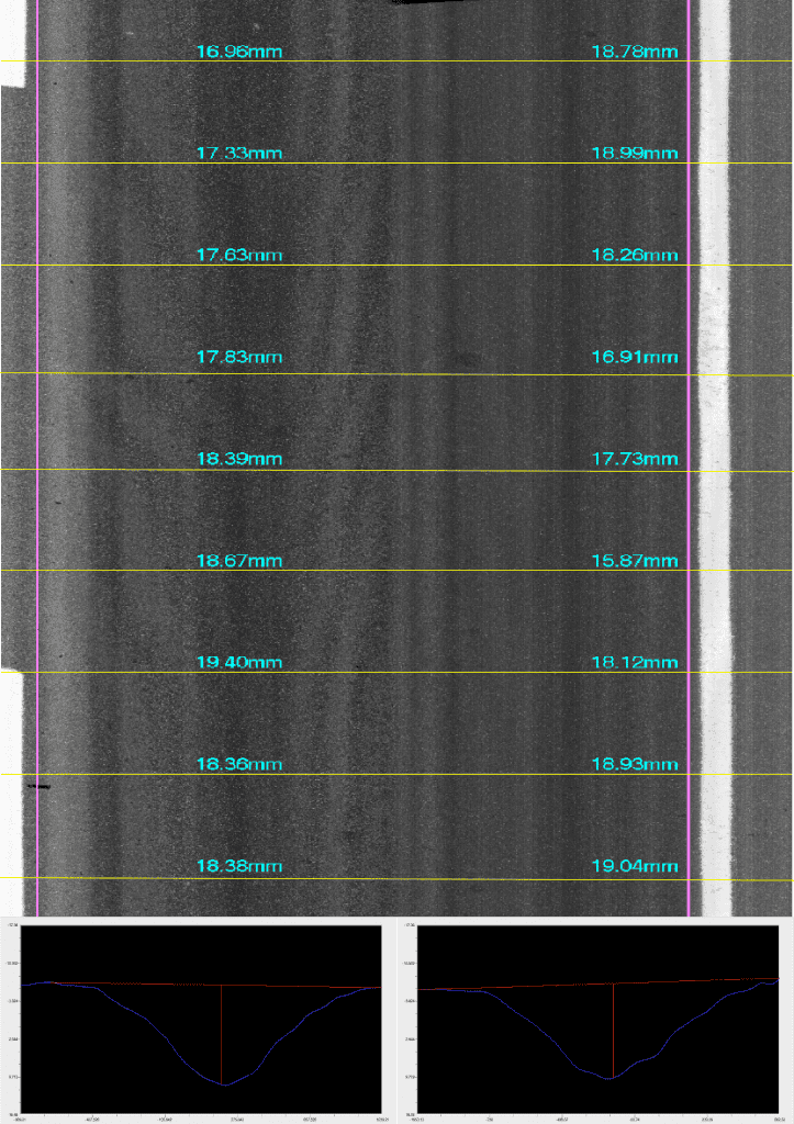
With more than 4,000 measurement points per transverse profile and sub-millimeter vertical accuracy, Pavemetrics® Laser Crack Measurement System (LCMS®-2) can report rutting with a high level of accuracy and repeatability.
Rut type, width (single or double), depth, cross section area and percentage of deformation can be reported for each road section at user-definable intervals.
As well, rutting depth can be calculated using a wide variety of industry-standard methods including:
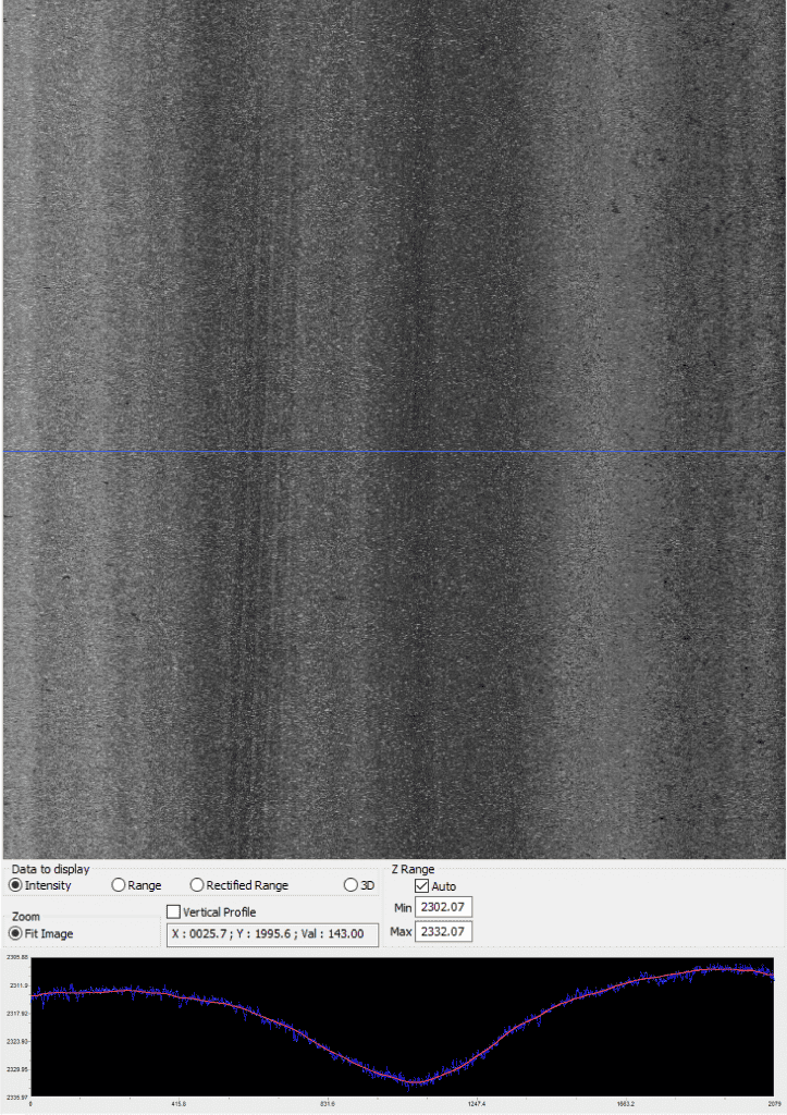
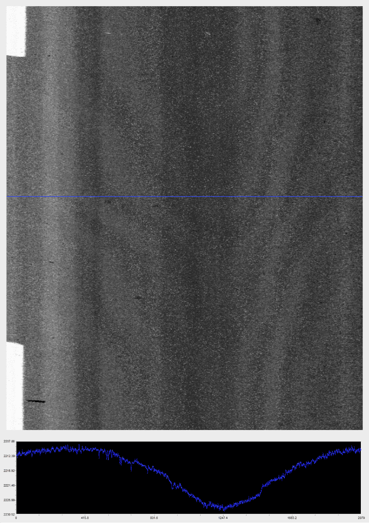
Rutting information is reported in XML format and both depths and measurement locations can be overlaid on a variety of 2D and 3D imaging for reporting.
Explore Eddyfi Technologies product lines